

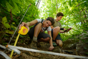
Every year, 3 million hikers gear up and set out with their backpacks to hike the Appalachian Trail.
“We call them NoBos—north bounders,” says Jeff Marion, a biologist with the U.S. Geological Survey who conducts studies in America’s national parks.
A regular hiker himself, Marion thinks it’s wonderful when people explore the great outdoors. Still, he says too many visitors can quickly become a problem when there’s an explosion in interest, as there has been during the COVID-19 pandemic. Technology, however, is being used to help manage the flow so that America’s most beloved parks and trails can become more sustainable and stand the test of time.
America’s national parks struggle to survive their popularity
Forest managers were overwhelmed in 2021 when 15.9 million people visited the Blue Ridge Parkway, and 14.1 million explored Great Smoky Mountains National Park, estimates from the National Park Service show. Overcrowding was such a problem last year that the Senate Energy and Natural Resources Subcommittee held a hearing to discuss the impacts of all the congestion. Places like Arches National Park and Glacier National Park even experimented with reservations to handle increased visitor traffic.
With so many visitors, campsites look like music festivals, overrun with tents and trampled grass that prevent the area from fully recovering.

“When we get large numbers of visitors that want to visit these amazing, protected areas, there can be some negative impacts, and these impacts are wide-ranging,” says Marion, who studies the environmental impact of recreational activity in protected natural areas.
Soil erosion transforms firm trails into muddy, worn-out paths that double in size and disturb native plants. Contaminated streams hurt fish and other wildlife that depend on clean water to survive.
Funding to address these matters is limited, which leaves land managers using a piecemeal approach to try and fix it. “They subjectively evaluate conditions and know that they’ve got major problems in certain places,” Marion says. Perhaps they take a hike and discover “a big blowout on the backside of a mountain” and decide to fix it by implementing stone steps or relocating the trail. “It would be far better if they had objective baseline data that had centimeter accuracy of soil loss over a five-year period,” Marion says.
Preserving America’s trails with reliable data
Marion says that the last 15 years have been a boon in terms of technology’s ability to measure the impacts of human behavior on nature and have dramatically increased his team’s capability to monitor the effects of tourists.

One such technology—light detecting and ranging—(commonly known as LiDAR) uses light waves to record different locations of objects in the woods in order to build a 3D image of the landscape and reveal terrain characteristics that would otherwise be hard to measure. It’s been used widely across the U.S., from the Appalachian Trail to out west in places like Rocky Mountain National Park, the Pacific Coast Trail, Mount Whitney, Yosemite National Park and North Cascades National Park.
LiDAR works by activating sensors that shoot out pulses of light. When the light hits a solid object, such as a tree or a rock, it bounces back to the sensor. The sensor records the amount of time it took for the flash of light to travel from the sensor to the object and back, then uses this information to calculate where the object is in relation to the sensor. When done enough times in a designated area, researchers can create a 3D model of the landscape.
Then, once Marion and his team capture this data, they enter it into a Geographic Information System (GIS)—a platform that analyzes the LiDAR spatial data alongside physical attributes of the landscape, such as soil type, the slope of the land around a trail or campsite, or the size of a watershed, which channels rainfall to rivers and streams.
GIS can even identify areas where fires have taken place, which is crucial to determining the chances of soil loss along trails, as well as identifying ideal areas for campsites.
“It’s probably okay to put a campsite into an area that burned within the last 10 years because the trees generally fall down in the first year,” Marion says. “By knowing how long ago there was a forest fire, you can then start thinking about how dangerous it is for camping to occur in that particular forested area.”
Representatives from national parks and protected wilderness areas often reach out to Marion and his team when they require research to solve a problem. Marion says there are few people who do the work they do, with only four universities teaching recreation ecology at the graduate level, but he predicts that LiDAR data will continue to grow in popularity and use.
Johanna Arredondo, a Ph.D. candidate in geospatial and environmental analysis at Virginia Tech who works closely with Marion, says that they also use predictive analytics software to determine how landscape characteristics interact with each other so that they can pick out the most influential variables for land managers who are responsible for these protected areas.
“Managers can harness that information to figure out what are the most effective management strategies they can use to mitigate those impacts,” Arredondo says.
Once researchers identify which factors influence soil loss on trails, they can use this information to create a model of an entire trail system. “You could give us the trail system for a huge, protected area, like Great Smoky Mountain National Park, with 500 miles of trail, and we could then model where we would expect to see erosion be the worst and which sections of the trail where erosion might be the least.”
Technology has had a profound impact, and it’s dramatically increased our capability to model visitor impacts in the real world.
—Jeff Marion, biologist, U.S. Geological Survey
Having this information is crucial for land managers—if they have limited money or staffing, managers can use the resources they have to fix the most highly impacted parts of a trail first. It can also help designate trail usage so that the trail is more sustainable over time. For instance, a manager might decide to only let horseback riders use rocky trails and allocate other trails to hikers or mountain bikers for lighter usage.
Crowd control is another huge benefit of LiDAR data, which can be used to determine the impact of visitors on trails and campsites. For example, Marion and his fellow researchers used LiDAR data and statistical modeling to help ease congestion at a popular spot on the Appalachian Trail: Georgia’s Hawk Mountain. The U.S. Forest Service sought Marion’s help when they were trying to determine the best location for new campsites. Based on Marion’s research, the U.S. Forest Service decided to shift camping from 16 large campsites clustered around the shelter to a new set of small side-hill campsites, drastically reducing the total area of camping impact. These changes helped address exceptionally high use areas and improved the sustainability of the Appalachian Trail and campgrounds for years to come.
The impact of climate change
Marion says that climate change is having a big impact on trail systems and campsites. “We’re absolutely getting hundred-year floods more frequently, like every 20 years now.” This means that forest managers need to design and manage their trails to withstand heavier rainfalls.
In addition, wildfires are affecting soil loss by wiping out the vegetation that holds soil in place, and “if you follow that with any kind of rainstorm, that’s going to displace a lot of soil and the landscape,” Marion says.

Fortunately, having GIS computer maps of the landscape gives managers the information they need to design their trails for extreme weather and keep hikers safe while they explore them. “Just like roads and bridges, trails need to be designed and managed to deal with bigger rainfall events.” This might mean, for example, building a trail with a larger culvert to help manage the flow of water.
“Technology has had a profound impact, and it’s dramatically increased our capability to model visitor impacts in the real world,” Marion says. “When you combine what you measure on the ground with what you can assemble in the digital space, you get substantially improved capabilities.”
Lead photo by Ryan Stone/Unsplash